.jpg)
Over the weekend, wind chills will be deathly cold
LAFOLLETTE, TN (WLAF)- A powerful Arctic blast is headed our way as extreme cold returns Friday night through the weekend. Below zero wind chills are forecast for Friday night through Sunday afternoon. That’s when the Wind Chill Indices will range from minus five to minus 10.
The strong winds will blow the expected snow around at times creating visibility challenges.
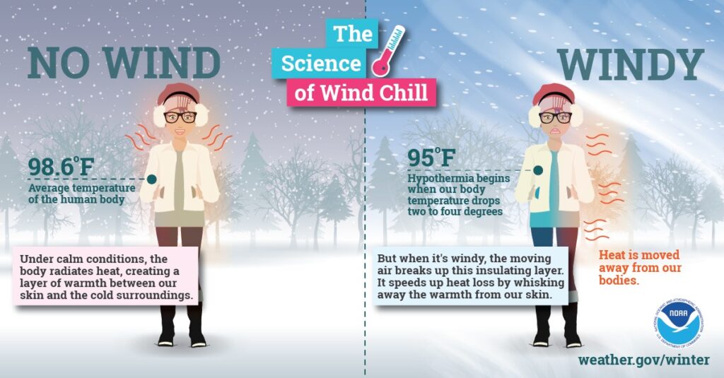
The wind chill temperature is how cold people and animals feel when outside. Wind chill is based on the rate of heat loss from exposed skin caused by wind and cold. As the wind increases, it draws heat from the body, driving down skin temperature and eventually the internal body temperature. Therefore, the wind makes it feel much colder. If the temperature is 0°F and the wind is blowing at 15 mph, the wind chill is -19°F. At this wind chill temperature, exposed skin can freeze in 30 minutes.
Safety tips:
If you have to go outside in extreme cold, dress for the conditions:
- Wear several layers of light-weight, warm clothing.
- Outer garments should be tightly woven, waterproof and hooded.
- For the hands, mittens are better then gloves…and make sure they are snug at the wrists.
Avoid overexertion, such as shoveling heavy snow, pushing a car, or walking in deep snow. The strain from the cold and the hard labor may cause a heart attack. Sweating could lead to chill and hypothermia. (WLAF NEWS PUBLISHED-01/30/2026-6AM-IMAGES AND TEXT COURTESY OF THE NATIONAL WEATHER SERVICE)