.jpg)
Expect isolated black ice and slippery spots during your Thursday commute
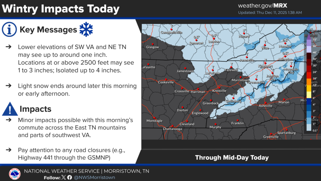
LAFOLLETTE, TN (WLAF)- Thursday morning temperatures will hover a shade above and a shade below the freezing mark creating slippery spots in areas that are seeing snow and sleet. Thursday’s skies slowly give-way to sunshine as temps hold in the 30s with cold wind chills.
Thursday night’s low dips to 30 with snow showers and rain showers from about 4am Friday until daybreak. Friday warms into the lower 50s ahead of a very cold Sunday and Monday.
A stronger surge of cold air will arrive for Sunday into Monday. Expect lows in the teens with some higher elevation single digits Monday morning. Lower wind chills will add to the cold. (WLAF NEWS PUBLISHED-12/11/2025-6AM-IMAGE COURTESY OF THE NWS MORRISTOWN)