.jpg)
A major winter storm is developing; likely to arrive early Saturday lingering into Sunday

LAFOLLETTE, TN (WLAF)- Once temperatures go below freezing Friday night they stay there until up in the week next week. With cold air in place and abundant moisture headed our way, the stage is being set for a potentially heavy snowfall Saturday into Sunday. At this moment, the time frame of the snow is from after midnight Friday through early Monday morning with the potential for periods of heavy snow.
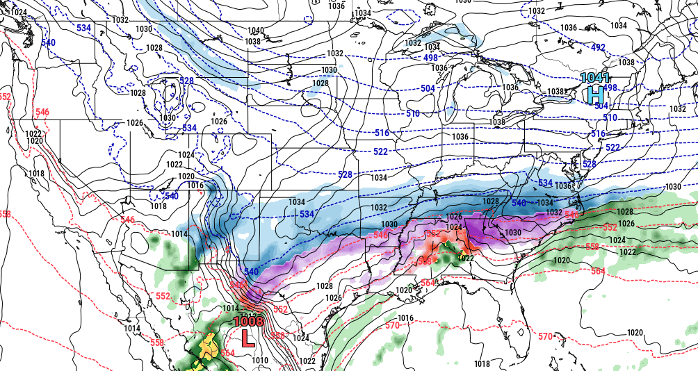
This model is looking ahead to late Sunday night.
Keep in mind that we are still several days out, and changes, in favor of snow or not, could change. From here, it appears it will be a snow event though we can’t rule out a mixed bag of winter precipitation. (WLAF NEWS PUBLISHED-01/20/2026-8PM-IMAGE COURTESY OF THE NWS MORRISTOWN & PIVOTAL WEATHER)