.jpg)
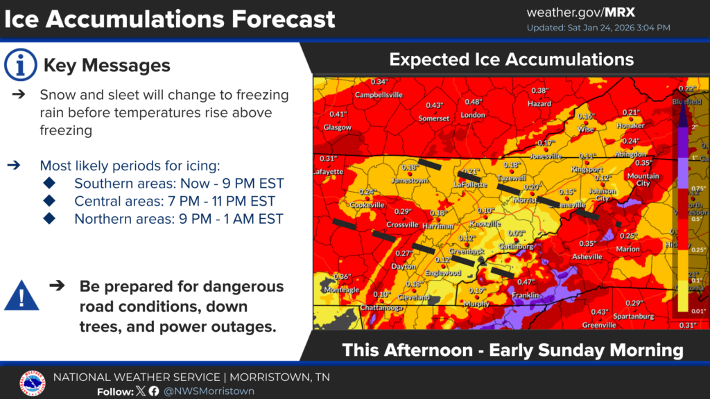
Snow and sleet accumulations may total around two-inches or more
LAFOLLETTE, TN- All precipitation types (rain, freezing rain, sleet, and snow) are expected over the next 24 hours as a significant winter storm moves through Campbell County and the southern Appalachian region. Saturday night’s low holds steady in the 20’s before rising to around 32-degrees early Sunday.
Sunday brings cold winds with rain showers and a high of 44.
– Light snow and sleet accumulations will be possible in the north, with icing potential having more significant impacts. The heaviest ice accumulations (over 0.25 inches) are most likely along the Cumberland Plateau/southern plateau, central and northeast East Tennessee, and just north of Interstate 40/81. Ice accumulations will be more uncertain along the foothills and southern Valley.
– High winds expected across the foothills of the mountains and ridge tops on Saturday night into Sunday.
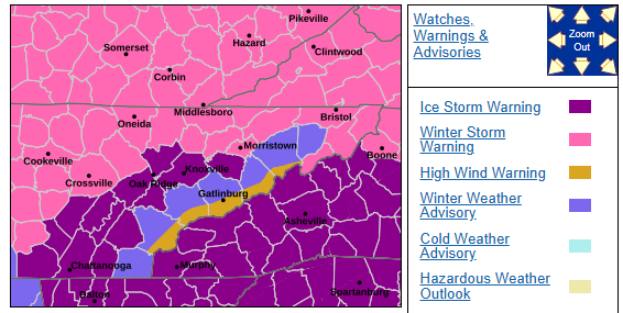
…WINTER STORM WARNING REMAINS IN EFFECT UNTIL 7 PM SUNDAY…
* WHAT…Heavy mixed precipitation expected. Total snow accumulations between a trace and two inches and ice accumulations between one tenth and four tenths of an inch.
* WHERE…Portions of Campbell County, East Tennessee and Southwest Virginia.
* WHEN…Until 7 PM EST Sunday.
* IMPACTS…Power outages and tree damage are likely due to the ice. Travel could be nearly impossible.
*PRECAUTIONARY/PREPAREDNESS ACTIONS… If you must travel, keep an extra flashlight, food, and water in your vehicle in case of an emergency. The latest road conditions for the state you are calling from can be obtained by calling 5 1 1.
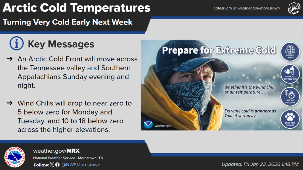
Extreme cold temperatures are expected Monday into Tuesday with highs well below freezing and overnight lows approaching or falling below 0. Lower wind chills are expected. (WLAF NEWS PUBLISHED-01/24/2026-6PM-TEXT & IMAGES COURTESY OF THE NWS MORRISTOWN)