Tennessee State Parks use new technology to mark trails, make parks more accessible

NASHVILLE, TN (SPECIAL TO WLAF)– Tennessee State Parks today announced the installation of signs at several parks across the state giving visitors detailed information developed from the use of new technology on the conditions expected on park trails. The new park signage is another example of how Tennessee has the most accessible state park system in the nation.
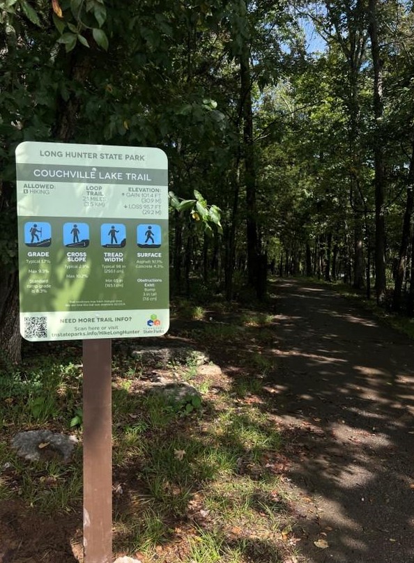
The information on the trail information signs is also available on the Tennessee State Parks website and will give visitors details such as the grade of a trail, the degree of the slope on the width of a trail, and the type of surface the trail provides. The details are especially helpful to park visitors who use wheelchairs or may need the assistance of an all-terrain wheelchair, available to reserve at many parks at no cost. The new signs and detailed information provide better guidance than broad descriptions used in the past, such as “difficult” or “easy.”

“We want everyone to have the same opportunities to enjoy our beautiful state parks, and this specific information helps take the guesswork out of trails for people who are unfamiliar with them,” said Greer Tidwell, deputy commissioner of the Bureau of Conservation at the Tennessee Department of Environment and Conservation. “Visitors can assess a trail based on whether it meets their specific desires and abilities. We are committed to providing all visitors the best experience possible and offering this detailed information at the parks and online shows our commitment.”
Tennessee is the first state to use High-Efficiency Trail Assessment Process (HETAP) to provide such information. This modern technology measures specific details such as length, grade, and possible obstructions on a trail, helping hikers decide whether or not they want to use a trail.
The trail assessors are funded by TDEC’s Access 2030, an initiative for Tennessee to have the most accessible state park system in the nation. The Tennessee State Parks Conservancy, a nonprofit fundraising partner of the parks, purchased one of the HETAP units.
The number of parks and trails with the signs will expand across the state. Parks with trail information posted on signs at the park and online currently include:
East Tennessee
Cove Lake State Park
Indian Mountain State Park
Norris Dam State Park
Panther Creek State Park
Red Clay State Historic Park
Rocky Fork State Park
Seven Islands State Birding Park
Warriors’ Path State Park

West Tennessee
Meeman-Shelby Forest State Park
Middle Fork Bottoms State Park
Pickwick Landing State Park
Pinson Mounds State Archaeological Park
Reelfoot Lake State Park
Middle Tennessee
Fall Creek Falls State Park
Harpeth River State Park
Johnsonville State Historic Park
Long Hunter State Park
Sgt. Alvin C. York State Historic Park
Visit the Tennessee State Parks website for more information, including an educational video, on the trail information signs. The site includes information on the parks, trail types, and explanations of the data on the signs.
Tennessee State Parks have 1,100 miles of trails. Entry to all 62 of the parks is free. If visitors care to assist in the care of the trails, they may contribute to the Trail Pack, which protects, enhances, and constructs trails, and contributions are welcomed. (WLAF NEWS PUBLISHED-11/19/2025-6AM)

.jpg)