.jpg)
The first round could form Friday afternoon

LAFOLLETTE, TN (SPECIAL TO WLAF)- Expect a partly sunny, breezy day Friday with highs well up into the 80s (84). The day brings a muggy feel to go along with the threat of showers and thunderstorms.
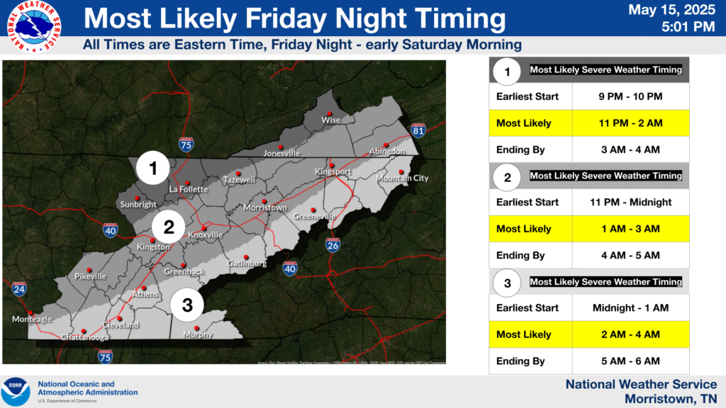
A few strong to severe storms are possible during the day on Friday but confidence is low for overall storm coverage. Higher confidence exists for strong to severe storms to occur Friday night into Saturday morning. Damaging straight line winds up to 70 mph and large hail up to 1.5″ are the primary threats with a low probabilities of tornadoes.
Timing estimates for the line of severe storms Friday night place Campbell County in a time frame of 9pm until 4am Saturday with the most likely time being 11pm through 2am.
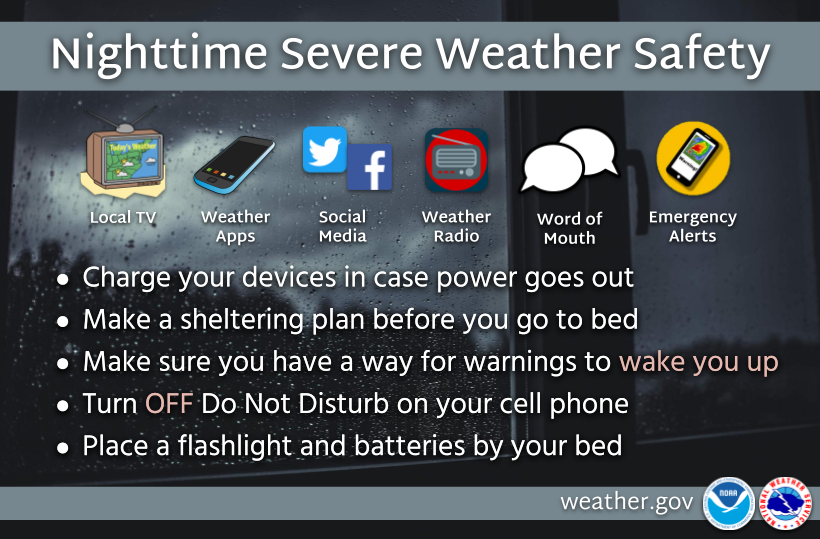
Please have multiple ways to receive watches or warnings such as NOAA Weather Radio and Wireless Emergency Alerts (WEA) on cell phones.
(WLAF NEWS PUBLISHED-05/16/2025-4AM-GRAPHICS AND TEXT COURTESY OF THE NWS MORRISTOWN)