.jpg)
Dramatic weather changes begin not long after daybreak Friday
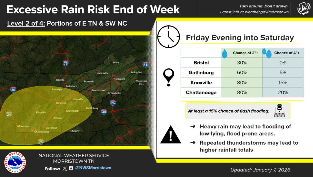
LAFOLLETTE, TN (WLAF)- Dry and unseasonably mild conditions are expected again today before a strong system approaches Campbell County and the area on Friday. We’ll see more clouds than sun on Thursday with windy conditions and a high of 65.
Off and on mountain wave high winds are likely Thursday night into Friday morning and again on Friday night into Saturday morning. Damaging wind is possible within some of the stronger storms.
Multiple rounds of showers and embedded storms are expected from Friday into Saturday. Locally heavy rainfall could lead to isolated flooding.
Seasonally colder conditions will return by Sunday into early next week with chances for high elevation snow showers on Sunday. (WLAF NEWS PUBLISHED-01/08/2026-6AM-TEXT & IMAGESS COURTESY OF THE NWS MORRISTOWN)