.jpg)
LAFOLLETTE, TN (WLAF) – Enjoy Friday’s sun and 60s, because we’re going to pay for it in full on Saturday. Beginning Friday evening, a WINTER STORM WATCH runs through sundown Saturday.
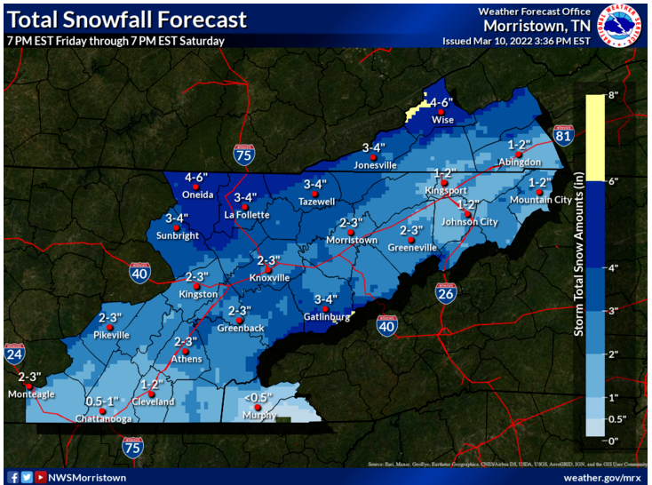
Rain develops Friday evening and changes to snow after midnight as temperatures chill to 23 and stay below freezing until Sunday afternoon. Rain changes to a wet, heavy snow around 3am and is expected to come at a fast pace at times through 8am with accumulations of one to two inches possible. Saturday brings more snow through the day to go along with dangerously cold wind chills and additional snow accumulation. Total snow accumulations could range from two to four inches.
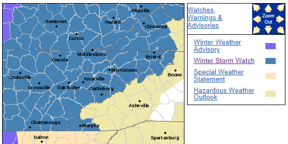
...WINTER STORM WATCH REMAINS IN EFFECT FROM FRIDAY EVENING THROUGH SATURDAY EVENING...

* WHAT...Heavy snow possible. Total snow accumulation of 2 to 4 inches possible, with 4 to 6 inches possible over portions of Campbell County, the Plateau, Southwest Virginia, and the East Tennessee mountains. Winds could gust as high as 35 mph.

* WHERE...Campbell County and all of east Tennessee, southwest Virginia and southwest North Carolina.

* WHEN...From late Friday evening through Saturday evening.

* IMPACTS...Plan on slippery road conditions.

* ADDITIONAL DETAILS...Snow could also accumulate in trees which might make them weak or unstable in the gusty winds. Some power outages could be possible.

PRECAUTIONARY/PREPAREDNESS ACTIONS...

Monitor WLAF for the latest forecasts for updates on this situation.
Skies clear Saturday night with temperatures dropping all the way to 11-degrees with wind chills around zero. Temps climb above freezing by Sunday afternoon under a sunny sky. (WLAF NEWS PUBLISHED – 03/11/2022-3AM)