.jpg)
By Charlie Hutson
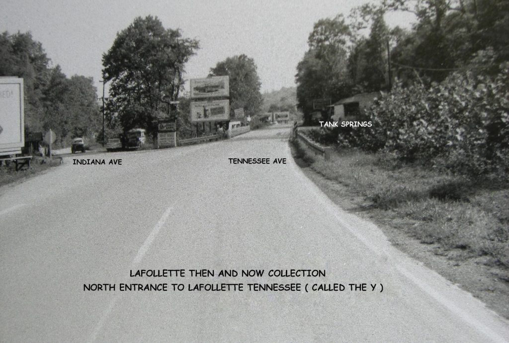
LAFOLLETTE, TN (WLAF) – The picture is a view of what was called the Y. This image was taken in the 1960s near where the Big Rock Tavern is today. This was the view of the north entrance to Lafollette from the late 1930s till the late 1980s.
Traveling south on U.S. Hwy 25W, the main Hwy 25W route ran across Big Creek by way of the Tank Springs Bridge and right by Tank Springs on into town on North Tennessee Avenue. Tank Springs is still there today, and for years, locals have used the water and still do today.
In the very late 1980s, things changed. A new bridge was built further downstream, and that new bridge was later named the Lobertini Bridge.
With the new bridge, the Hwy 25W traffic pattern changed sending travelers down North Indiana Avenue into town. Now 30 years later, just like when it first changed, drivers turn right onto Lobertini Bridge to cross Big Creek to travel down North Tennessee Avenue.
Up near Tank Springs is still the concrete head walls on both sides of the creek where the old bridge once rested. (WLAF NEWS PUBLISHED 1/27/22- 6AM)
Hi Charlie, Thanks for the memory. That’s the way I still think of it the most as I don’t get to LaFollette as often as I used to. I am curious if the road change curbed access to the watering hole that people for so many years used to fill up gallon jugs of water from and if not is it still used very much. It used to be common to see two or three cars at a time there with people waiting to fill up their gallon jugs.
I used to come the mountain and hit that entrance pretty fast…but then you knew to slow down in a big hurry. Was handy as well to coast into town when one ran out of go go juice. (Gas)